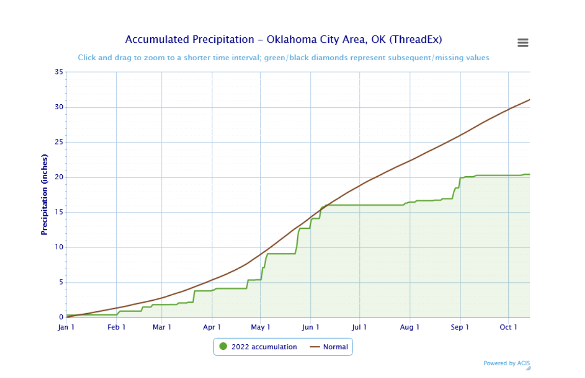
It’s been dry this year. From the start of the year to October 14, we’ve only had 23.25” of rain in the Oklahoma City area, which is the driest start to any year since 2003. It is also well below the average year-to-date precipitation of 34.26”. This lack of rain has put most of the state in an extreme or exceptional drought, the two worst categories of drought in the U.S. Drought Monitor. The last time the drought was so bad was back in 2013. This drought has been hard on agriculture and led to reduced crop yields. Many trees have also lost their leaves prematurely due to the drought.
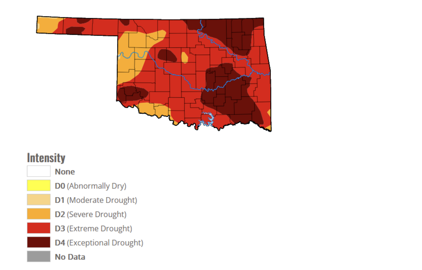
This map shows the drought categories across the state as of October 13, 2022.
Why has it been so dry? We’ve had two periods of frequent high pressure and limited rain, one last winter and one this summer. High pressure occurs when air sinks over an area. The sinking air tends to cause the relative humidity of the air to decrease, which prevents clouds from forming. The jet stream flows around high pressure, which in this case kept rain and storms away from the area. The high pressure also caused the heat to worsen, making this summer the hottest since 2012. We hit 100°F a total of 24 times, and tied our July record high of 110. This heat also made the lack of rain worse, as it allowed water vapor to evaporate faster, which further worsened the drought. This kind of feedback can often happen during drought conditions, leading to a phenomenon known as flash drought.
As I write this, there is some rain predicted tonight, but the long-term trends do not look favorable for heavy rainfall. It remains to be seen if this drought will improve or if it will continue to worsen.
By Stephen Foskey
References:
https://psl.noaa.gov/data/atmoswrit/map/
https://www.drought.gov/what-is-drought/flash-drought
https://education.nationalgeographic.org/resource/atmospheric-pressure
https://www.beefmagazine.com/beef/oklahoma-drought-conditions-worsening